Trip Planning Tools and Apps for Sustainable Transportation in DC
Navigating public transportation in DC, especially with ongoing changes from the Better Bus Network, can be overwhelming for both commuters and visitors. Frequent route updates, new signage, and shifting schedules often leave people confused and frustrated, pushing many to drive instead of using more sustainable options.
Trip planning tools and apps take the guesswork out of your journey to simplify your commute, offer real-time updates, provide route suggestions, and show easy-to-follow directions so you can confidently choose biking, walking, scooting, or taking public transit. Whether you’re a regular user of sustainable transportation or just beginning to explore new commuting options, keep reading to discover how you can plan your trips more effectively and commute smarter, not harder!
The Basics of Planning Your Trip
Planning a sustainable trip in the District is easier when you follow these three easy steps:
- Know your start and end point: Start by knowing where you’re going and how far your commute will be. This can help you decide which mode would be best.
- Pick your mode: Consider the time of day (off-peak vs. high-volume traffic), weather, and availability.
- Plan your trip using tools and apps: Use these tools to discover the fastest and most convenient routes, including any service delays or availability
(bike/scooters).
Trip Planning: Tools, Apps, and Recommendations
Here are some of the most effective tools and apps to plan your sustainable travel, as well as recommendations for each mode:
 | WMATA’s Trip Planner: WMATA’s Trip Planner is the official tool from the Washington Metropolitan Area Transit Authority (WMATA) and a go-to resource to navigate Metrorail and Metrobus. After entering your start and end points, you will receive detailed transit directions, including travel time, fare estimates, and walking directions between each stop. WMATA also offers a video walk-through of how to use the Trip Planner! Recommended: Metrobus and Metrorail |
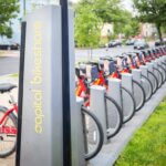 | Capital Bikeshare System Map: The Capital Bikeshare System Map is a live map showcasing available classic bikes, ebikes, and open docks at each station. It also provides the estimated range of each bike. This tool helps you quickly find the closest Capital Bikeshare stations with bikes or docks available—right from their website or app. Recommended: Biking |
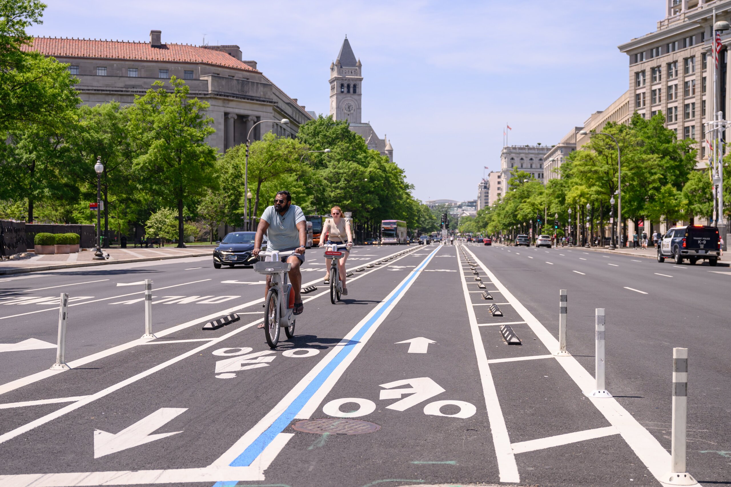
 | Google Maps: Google Maps remains a reliable option offering walking, biking, and public transit directions, along with estimated arrival times and route comparisons. It pulls in real-time data from Metro and bus systems and even provides bike-friendly routes with elevation and bike lane info. Recommended: Biking, walking, scooting, and public transportation |
 | Transit App: Transit App is another commuter-friendly app that provides up-to-the-minute schedules for buses, trains, and other public transit services. What sets Transit app apart is its ability to integrate multiple systems into one easy navigation platform, so you don’t have to jump between websites. It also offers alerts for service disruptions, large crowds, and bike/scooter availability. Recommended: Public transportation |
 | CityMapper: The CityMapper app is a top pick with its abilities to pull real-time data from multiple transportation providers. This app lets you compare all available options —from biking and walking to Metro and rideshare. Not only does Citymapper show estimated travel times, but it also gives insights into the environmental impact of each mode. Overall, it makes it easy to tailor your trip based on speed, convenience, and sustainability. Recommended: Biking, walking, scooting, and public transportation |
 | Metro and Bus: The Metro and Bus app shows real-time transit info for Metrorail and Metrobus. It’s best used for those that already know their route but want to see when their bus/train will be arriving. Just choose your station, line, or route to get up-to-date arrival information. Recommended: Public transportation
|
MetroHero: MetroHero is another Metro-focused tool that shows real-time train positions, crowd levels, delays, and other system insights not typically available through standard trip planners. It’s perfect for seasoned commuters who want to track Metro’s reliability and make informed decisions during peak hours or service disruptions. Recommended: Metrobus and Metrorail | |
Ridehail/Carshare Apps: Apps like Uber and Lyft can support travel when used to close first-mile/last-mile gaps or connect to transit. For short-term car access, services like Zipcar allow you to rent by the hour, which can reduce the need for personal vehicle ownership. Visit the provider’s website or app for locations, wait times, and pricing. Recommended: Ridehail and carshare | |
 | Strava: Strava is a fitness-focused app popular among cyclists and runners, but it’s also a powerful planning tool for sustainable travel. Many commuters use Strava to map and track bike routes; monitor ride times; and explore safe, popular cycling paths. The app’s heat maps show where others commonly ride, which can help new cyclists find safer or more direct routes. Recommended: Biking, scooting, and walking |
 | DC Bike Map: The DC Bike Map provides a comprehensive overview of the city’s bike infrastructure, including trails, bike lanes, and suggested routes. Available in print and digital formats, this map is a great resource for planning bike commutes, especially for those unfamiliar with the safest streets to ride. It includes tips for riding in traffic and highlights connections to transit. It is ideal for beginner and experienced cyclists alike. Recommended: Biking, scooting, and walking |
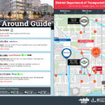 | goDCgo’s Getting to Guides: Getting to guides are downloadable, user-friendly travel guides tailored to popular destinations in DC. They show available walking, biking, transit, and micromobility options to popular destinations in the District, making them perfect for both locals and visitors. Each guide includes a map and sustainable route recommendations. ls Park, Audi Field, and more! Recommended: Biking, walking, scooting, and public transportation |
 | Slugging Tools: Though not app-based, slugging is a zero-cost, people-powered solution that promotes sustainability by reducing the number of single-occupancy vehicles on the road. Local websites and Facebook groups offer guidance on locations to plan your trip. Check out our Slugging 101 blog for helpful websites! Recommended: Slugging |
Planning your trip with the right tools makes getting around DC more convenient, flexible, and reliable. Take advantage of these trip planning tools and apps to navigate confidently with sustainable transportation.