Find the Bike Route for You!
by Samantha Huff
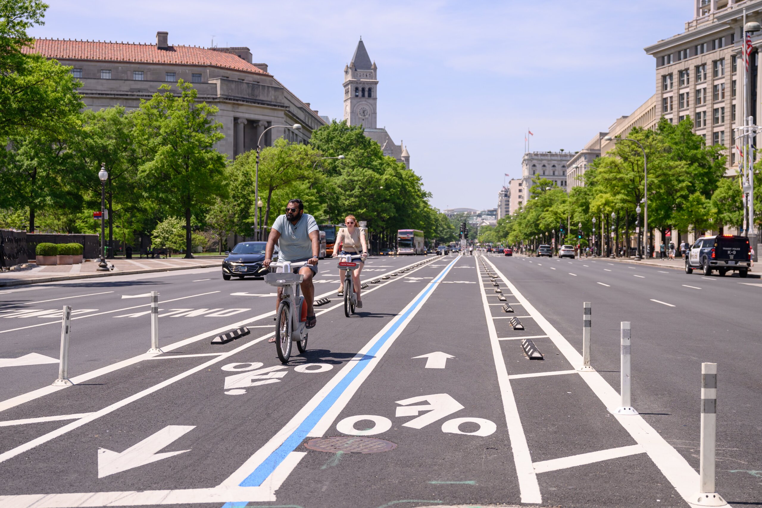
Ready to get your roll on this summer?! Washington, DC has 150 miles of bike lanes and trails for you to discover. goDCgo teamed up with the Washington Area Bicyclist Association (WABA) to customize different bike routes throughout the District that cater to your bike skill level. Whether you’re a beginner biker, avid cyclist, or anywhere in between, you’re sure to find the best bike route for you. For your convenience, each bike route features Ride with GPS turn-by-turn directions so you can navigate each trail with ease.
Keep in mind that you should still practice proper biking etiquette and safe social distancing when sharing the trails. Check out the custom bike route options below.
Beginner Bike Routes
Anacostia Riverwalk Trail
Distance: 30-90 minutes or 5-14 miles
Start/End Location: Anacostia Recreation Center, 1800 Anacostia Dr, Washington, DC 20020
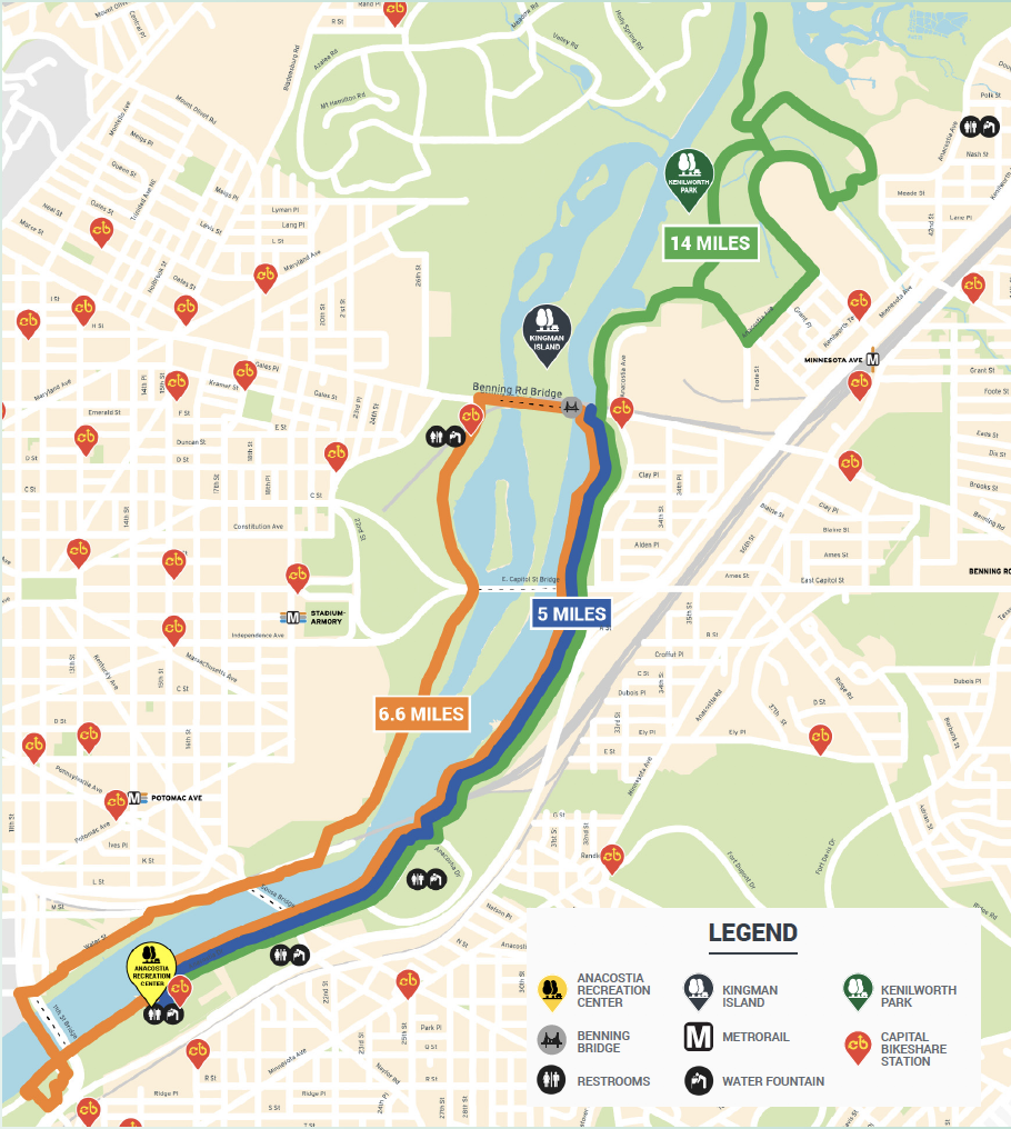
Have you recently learned how to ride a bike or haven’t ridden in a long time? This route is for you! The Anacostia Riverwalk Trail is low-stress with few intersections and limited interactions with cars. The route starts at the Capital Bikeshare station* in front of the Anacostia Recreation Center and travels east.
Riders can choose between three segments:
- 5-mile round trip route to Benning Bridge and back
- 6.6-mile route over Benning Bridge through Kingman Island
- 14-mile round trip route past Benning Bridge to Kenilworth Park
Depending on the route you take, you could catch turtle and other wildlife sightings! But whatever route you choose, you’ll get to pass through the urban oasis that is Anacostia Park and take in scenic views of the Anacostia River.
Download the Beginner Bike Routes map.
Moderate Bike Routes
Oxon Run Trail
Distance: 20 minutes or 3.5 miles per loop
Start/End Location: Capital Bikeshare at Valley Ave & Wheeler Rd SE, Washington, DC 20032
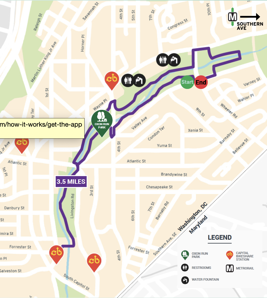 If you know how to ride a bike, but may not typically ride for recreation or fitness, this route is for you! Despite being a relatively short and flat route, the Oxon Run Trail is ideal for intermediate riders due to several mild inclines and street crossings. You’ll start behind the Southeast Tennis and Learning Center next to the Capital Bikeshare station* and weave through Oxon Run Park. While you ride, you’ll find plenty of recreation options like a pool, tennis and basketball courts, baseball fields, and playgrounds. If you’re feeling up to it, take two or more loops around the trail!
Rock Creek Trail
Distance: Up to 90 minutes or 12 miles
Stand/End Location: Capital Bikeshare at K St & 30th St NW, Washington, DC 20007
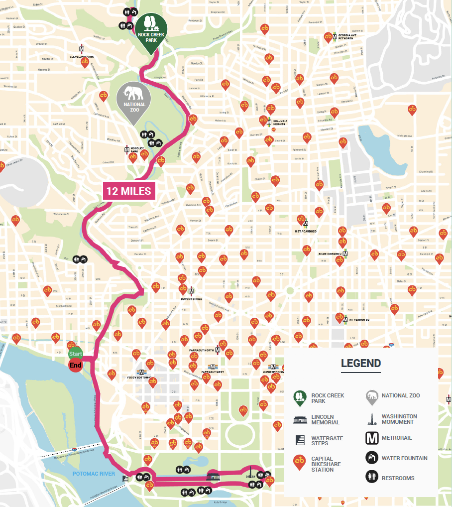
A local favorite, Rock Creek Trail is for cyclists looking for longer, scenic routes. You’ll start at the Capital Bikeshare station* at the Georgetown Waterfront and follow Rock Creek Trail to the National Mall and Rock Creek Park. Note that this route can get crowded so be patient, yield to pedestrians, and let people know when you are passing them.
From the Georgetown Waterfront under Whitehurst Freeway, start riding the trail along the Potomac River. Along the way, you’ll pass the Watergate Complex and Steps, the Kennedy Center, Lincoln Memorial, the Reflecting Pool, the National Zoo, and get great views of the skylines of Rosslyn across the river. Eventually, you’ll reach the C&O Canal. If you are looking for a long ride, the C&O Canal Towpath stretches 184.5 miles all the way to Cumberland, MD. On weekends, long sections of Beach Drive are closed to cars and the trail extends beyond the Maryland border all the way to Rockville.
Download the Moderate Bike Routes map.
Scenic Bike Routes
Rock Creek Trail
Distance: 30-60 mins or 5-8 miles
Start/End Location: Capital Bikeshare at K St & 30th St NW, Washington, DC 20007
Even though Rock Creek Trail is typically for cyclists looking for longer routes, there are shorter options! Scenic riverside trails and shared, multi-use paths take you through DC’s most iconic sights and the natural oasis that is Rock Creek Park. You’ll start at the Capital Bikeshare station* at the Georgetown Waterfront and follow Rock Creek Trail to the National Mall or Rock Creek Park.
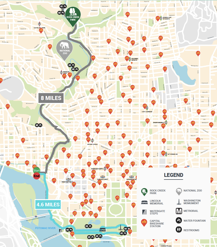 Riders can choose between two segments:
- 4.6-mile segment from Georgetown Waterfront to National Mall
- 8-mile segment from Georgetown Waterfront to Rock Creek Park (Peirce Mill)
Note that this route can get crowded so be patient, yield to pedestrians, and let people know when you are passing them.
Download the Scenic Bike Routes map.
For more information about cycling in the city, download the DC Bike Map or visit goDCgo.com/bike.